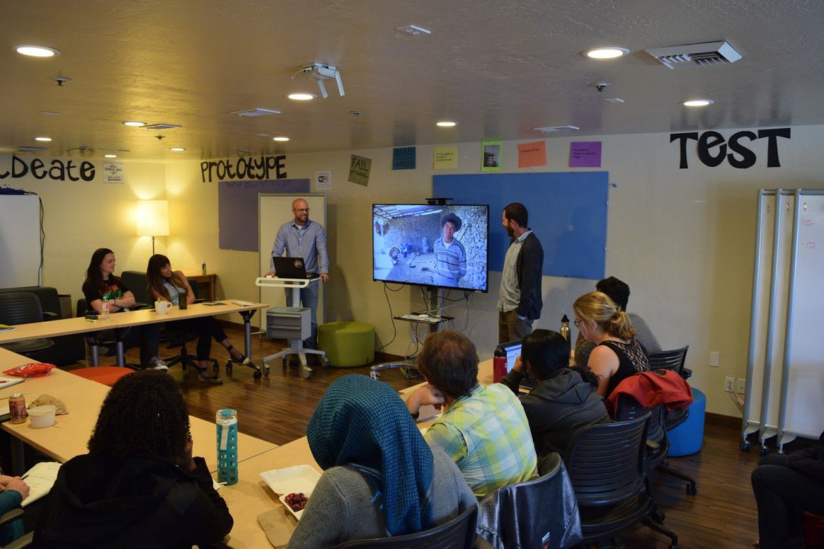
A lot of surveyors are still using outdated tools to calibrate land boundaries. We @adollatech are building something different — smart, fast & field-ready. If you work in mapping or boundary validation, you’ll want to keep an eye on this. #SurveyTech #MappingTools #LandSurvey

Kofi_Floki's tweet image. A lot of surveyors are still using outdated tools to calibrate land boundaries.
We @adollatech are building something different — smart, fast & field-ready.

If you work in mapping or boundary validation, you’ll want to keep an eye on this.

#SurveyTech #MappingTools #LandSurvey

10 years. Zero issues. That’s what we aim for. And it’s why professionals keep coming back. #TestimonialTuesday #MappingTools #CustomerLoyalty #PlanningWorkflows #ArchitectsUK #MapServe #TrustedByProfessionals
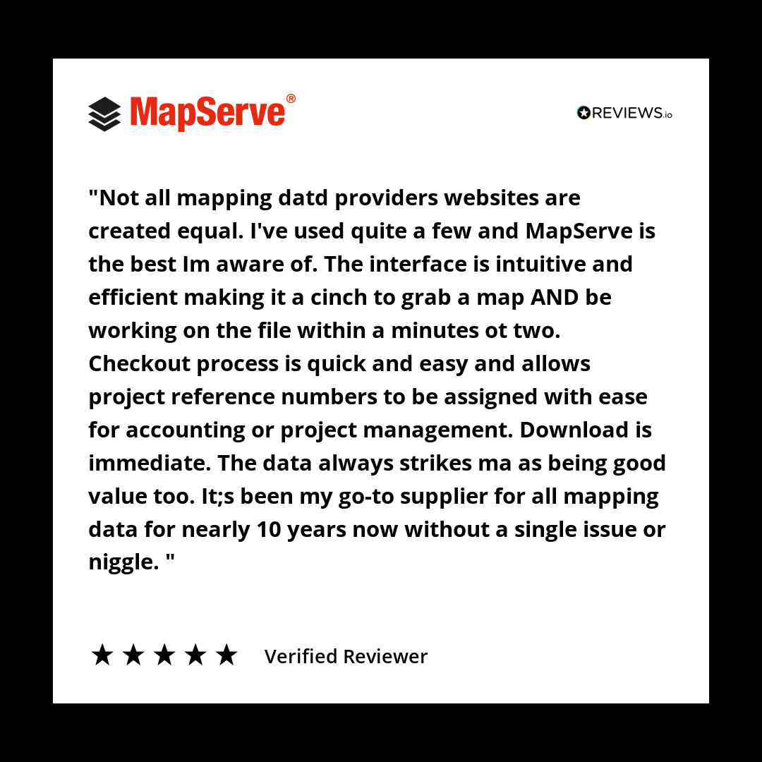
mapserve's tweet image. 10 years. Zero issues.

That’s what we aim for. And it’s why professionals keep coming back.

#TestimonialTuesday #MappingTools #CustomerLoyalty #PlanningWorkflows #ArchitectsUK #MapServe #TrustedByProfessionals

Gain unparalleled insight in your tilesets with the Tileset explorer, launched today! Visualize tileset statistics and metadata for deep understanding about your data distribution and size. buff.ly/391gYbC #mapbox #mappingtools

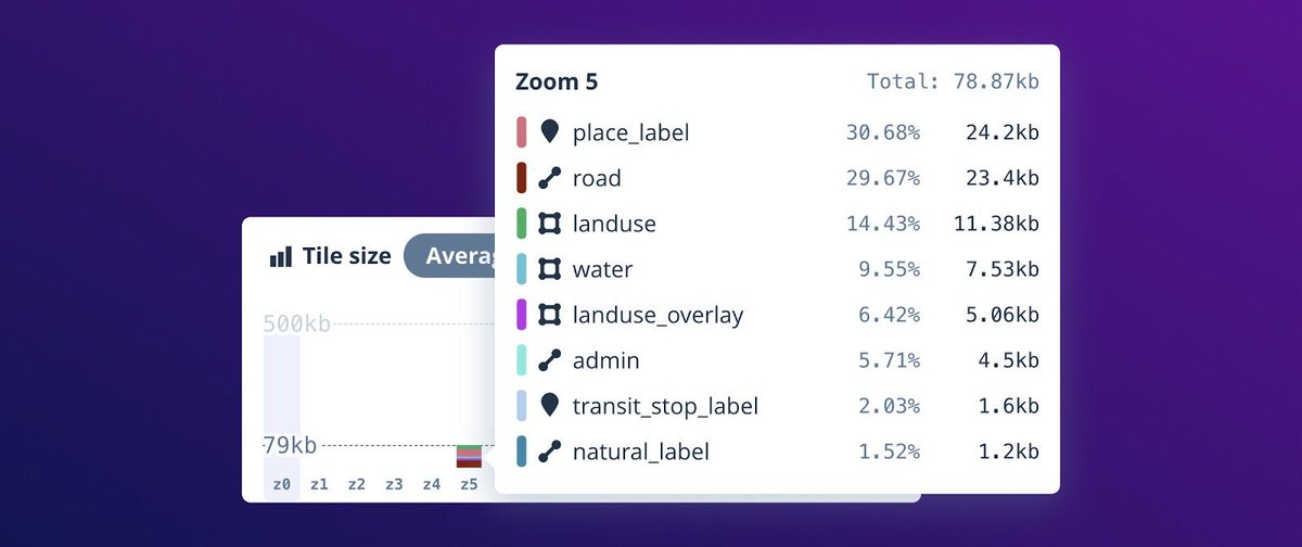
Mapbox's tweet image. Gain unparalleled insight in your tilesets with the Tileset explorer, launched today! Visualize tileset statistics and metadata for deep understanding about your data distribution and size. buff.ly/391gYbC #mapbox #mappingtools

Have you been using our Transpo Injury Mapping System? Updated TIMS website: tims.berkeley.edu #trafficsafety #mappingtools #SWITRS

UCBSafeTREC's tweet image. Have you been using our Transpo Injury Mapping System? Updated TIMS website: tims.berkeley.edu #trafficsafety #mappingtools #SWITRS

State technology experts want Tennesseans to use new #mappingtools they've made available, and have now produced instructional videos to help. More at greeneville.com/news.
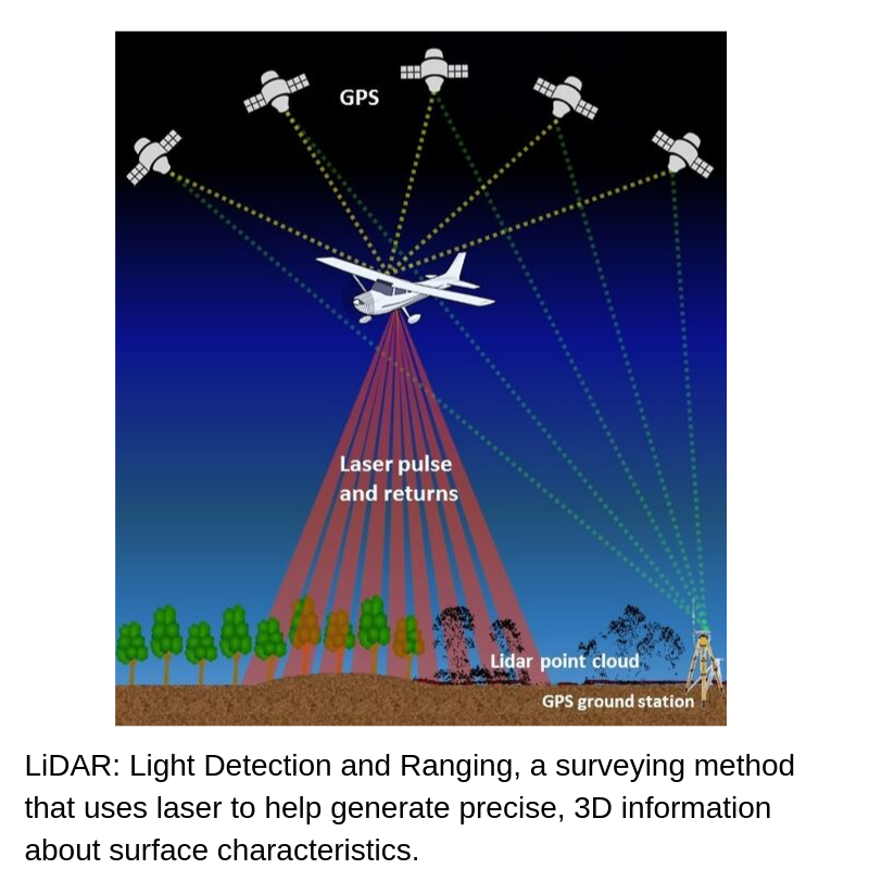
WGRVnews's tweet image. State technology experts want Tennesseans to use new #mappingtools they've made available, and have now produced instructional videos to help. More at greeneville.com/news.

Did you know? Our network of customers includes over 2.7 million registered #developers around the globe. Discover why developers love our powerful #mappingtools: mapbox.com/maps
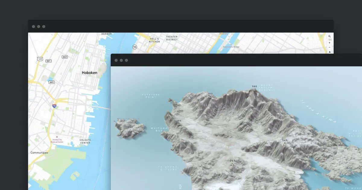
Mapbox's tweet image. Did you know? Our network of customers includes over 2.7 million registered #developers around the globe. Discover why developers love our powerful #mappingtools: mapbox.com/maps

Unlock property ownership insights with mapping tools, GIS, and public records! 🏘️ Discover how you can simplify real estate research and transactions in our latest guide. tycoonstory.com/why-mapping-to… #realestate #gis #mappingtools #propertyownership #realestateinvesting

TycoonStoryCo's tweet image. Unlock property ownership insights with mapping tools, GIS, and public records! 🏘️ 

Discover how you can simplify real estate research and transactions in our latest guide.

tycoonstory.com/why-mapping-to…

#realestate #gis #mappingtools #propertyownership #realestateinvesting

📍#GeoforGood23 Summit took place last week and the #SERVIRAmazonia team was well-represented 🙌🏼 The event gathered professionals worldwide using @Google #mappingtools for planetary #sustainability @googleearth @SERVIRGlobal @sig_gis @Imaflora @amazonacca 🌳 1/2

ServirAmazonia's tweet image. 📍#GeoforGood23 Summit took place last week and the #SERVIRAmazonia team was well-represented 🙌🏼 The event gathered professionals worldwide using @Google #mappingtools for planetary #sustainability @googleearth @SERVIRGlobal @sig_gis @Imaflora @amazonacca 🌳 1/2

Did you know that you can print your WellDatabase map? Use the print tool to create images up to 24x36. Learn more in the following article: hubs.la/Q02R5ZW90 #oilandgas #datamanagement #mappingtools #energyindustry


#MonitorPro Records GPS coordinates of readings and validates against the location of sample point. #seamlessintegration #mappingtools #EHSsoftware

EHSData's tweet image. #MonitorPro Records GPS coordinates of readings and validates against the location of sample point. #seamlessintegration  #mappingtools #EHSsoftware

New to GIS? Our ArcGIS Pro Intro course covers map navigation, data visualization, and spatial analysis—everything you need to build a strong foundation and unlock the power of ArcGIS. tcworkshop.com/pages/course-d… #ArcGISPro #MappingTools

tcworkshop's tweet image. New to GIS? Our ArcGIS Pro Intro course covers map navigation, data visualization, and spatial analysis—everything you need to build a strong foundation and unlock the power of ArcGIS.
tcworkshop.com/pages/course-d…
#ArcGISPro #MappingTools

🧰 18+ Extensions. One Plugin. Endless Possibilities. Whether you're mapping users, posts, or custom tables — WP Maps Pro has an extension for that! 🚀 Unlock the map power: wpmapspro.com #WordPressDev #MappingTools #WPMapsPro #WePlugins

weplugins's tweet image. 🧰 18+ Extensions. One Plugin. Endless Possibilities.

Whether you're mapping users, posts, or custom tables — WP Maps Pro has an extension for that!

🚀 Unlock the map power: wpmapspro.com

#WordPressDev #MappingTools #WPMapsPro #WePlugins

A formidable tool, @googleearth is used by many nonprofits to keep track and monitor the effects of climate change, deforestation, food supply and a plethora of other pressing issues. #geospataltechnology #mappingtools #amplifyimpact #googleearth #toolparetners #tech4good
Tech_4Good's tweet image. A formidable tool, @googleearth is used by many nonprofits to keep track and monitor the effects of climate change, deforestation, food supply and a plethora of other pressing issues. 

#geospataltechnology #mappingtools #amplifyimpact #googleearth  #toolparetners #tech4good

🌱Ecology of Social Movements #3 ✊ Gee & Neus will use movement #mappingtools to begin to analyse our own context & explore interventions or strategies for improving the health of our movement ecology 🗣Speakers: Gee, Programme Director & Neus, Project Manager at @UlexProject

Young_FoEE's tweet image. 🌱Ecology of Social Movements #3

✊ Gee & Neus will use movement #mappingtools to begin to analyse our own context & explore interventions or strategies for improving the health of our movement ecology

🗣Speakers: Gee, Programme Director & Neus, Project Manager at @UlexProject

🗺️ New Map Alert! ​ The Namibia Topographic Map is now available on the SAGTA Map Downloader — plus two new projects: 📚 South Africa & 🌍 Global Map Projects ​ 🔗Visit the SAGTA Map Downloader: maps.sagta.org.za #Kartoza #GIS #MappingTools

KartozaGeo's tweet image. 🗺️ New Map Alert!
​
The Namibia Topographic Map is now available on the SAGTA Map Downloader — plus two new projects:
📚 South Africa & 🌍 Global Map Projects
​
🔗Visit the SAGTA Map Downloader: maps.sagta.org.za

#Kartoza #GIS #MappingTools

Need building heights in your site plan? Quick how-to: ✅ Select your site ✅ Add building height layer (CAD only) ✅ Export to PNG in AutoCAD #AutoCAD #MappingTools #Architects #Surveyors


Explore les dashboards @TheLensOrg sur les données du labo. Extrêmement versatile; customisation des graph, exports (svg, data, etc)... #dataviz #bibliometrics #mappingtools #searchengines #ESR

amarois's tweet image. Explore les dashboards @TheLensOrg sur les données du labo. Extrêmement versatile; customisation des graph, exports (svg, data, etc)...
#dataviz #bibliometrics #mappingtools #searchengines #ESR

Sask1stcall.com now has improved mapping tools for your locate. Executive Director Lisa Kosolofski explains. Sask 1st Call Improved Mapping Tools. #Sask1stCall #MappingTools #SafeDigging #UtilitySafety youtu.be/QktqOAUj1ms
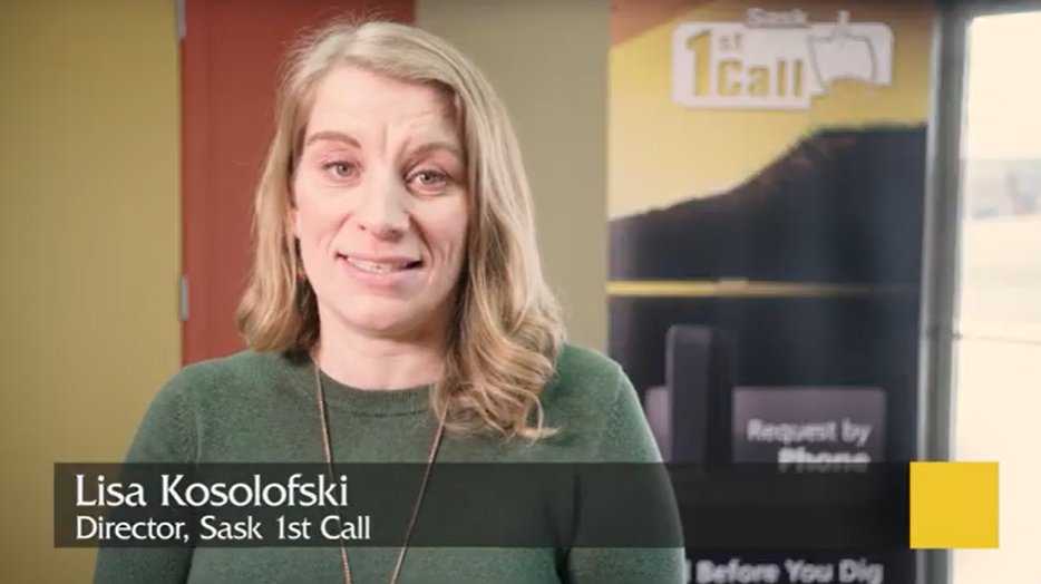
SaskCGA's tweet image. Sask1stcall.com now has improved mapping tools for your locate.  Executive Director Lisa Kosolofski explains. Sask 1st Call Improved Mapping Tools. #Sask1stCall #MappingTools #SafeDigging #UtilitySafety youtu.be/QktqOAUj1ms

Grid maps are an excellent tool for visualizing and analyzing large trends or identifying areas of high activity. A popular method of customizing your map is to use a grid map to display trends or hotspots for a specific property. bit.ly/3Ya0w0U #oilandgas #mappingtools

welldatabase's tweet image. Grid maps are an excellent tool for visualizing and analyzing large trends or identifying areas of high activity. A popular method of customizing your map is to use a grid map to display trends or hotspots for a specific property. bit.ly/3Ya0w0U
#oilandgas #mappingtools

10 years. Zero issues. That’s what we aim for. And it’s why professionals keep coming back. #TestimonialTuesday #MappingTools #CustomerLoyalty #PlanningWorkflows #ArchitectsUK #MapServe #TrustedByProfessionals

mapserve's tweet image. 10 years. Zero issues.

That’s what we aim for. And it’s why professionals keep coming back.

#TestimonialTuesday #MappingTools #CustomerLoyalty #PlanningWorkflows #ArchitectsUK #MapServe #TrustedByProfessionals

Sask1stcall.com now has improved mapping tools for your locate. Executive Director Lisa Kosolofski explains. Sask 1st Call Improved Mapping Tools. #Sask1stCall #MappingTools #SafeDigging #UtilitySafety youtu.be/QktqOAUj1ms

SaskCGA's tweet image. Sask1stcall.com now has improved mapping tools for your locate.  Executive Director Lisa Kosolofski explains. Sask 1st Call Improved Mapping Tools. #Sask1stCall #MappingTools #SafeDigging #UtilitySafety youtu.be/QktqOAUj1ms

Medical coding is costly, slow, and error-prone—but AI is changing that. With up to 75% faster coding and 95%+ accuracy, AI tools cut claim denials and boost revenue, all while improving patient care. Discover: awesmai.com/tools/free-ai-… #awesmai #AI #mappingtools #freeaitools


Need building heights in your site plan? Quick how-to: ✅ Select your site ✅ Add building height layer (CAD only) ✅ Export to PNG in AutoCAD #AutoCAD #MappingTools #Architects #Surveyors


Fast access, fair pricing, and support that actually replies. We don’t overcomplicate things. That’s the point. #TestimonialTuesday #CustomerSupport #MappingTools #SitePlans #RemotePlanning #MapServe #PlanningWorkflows
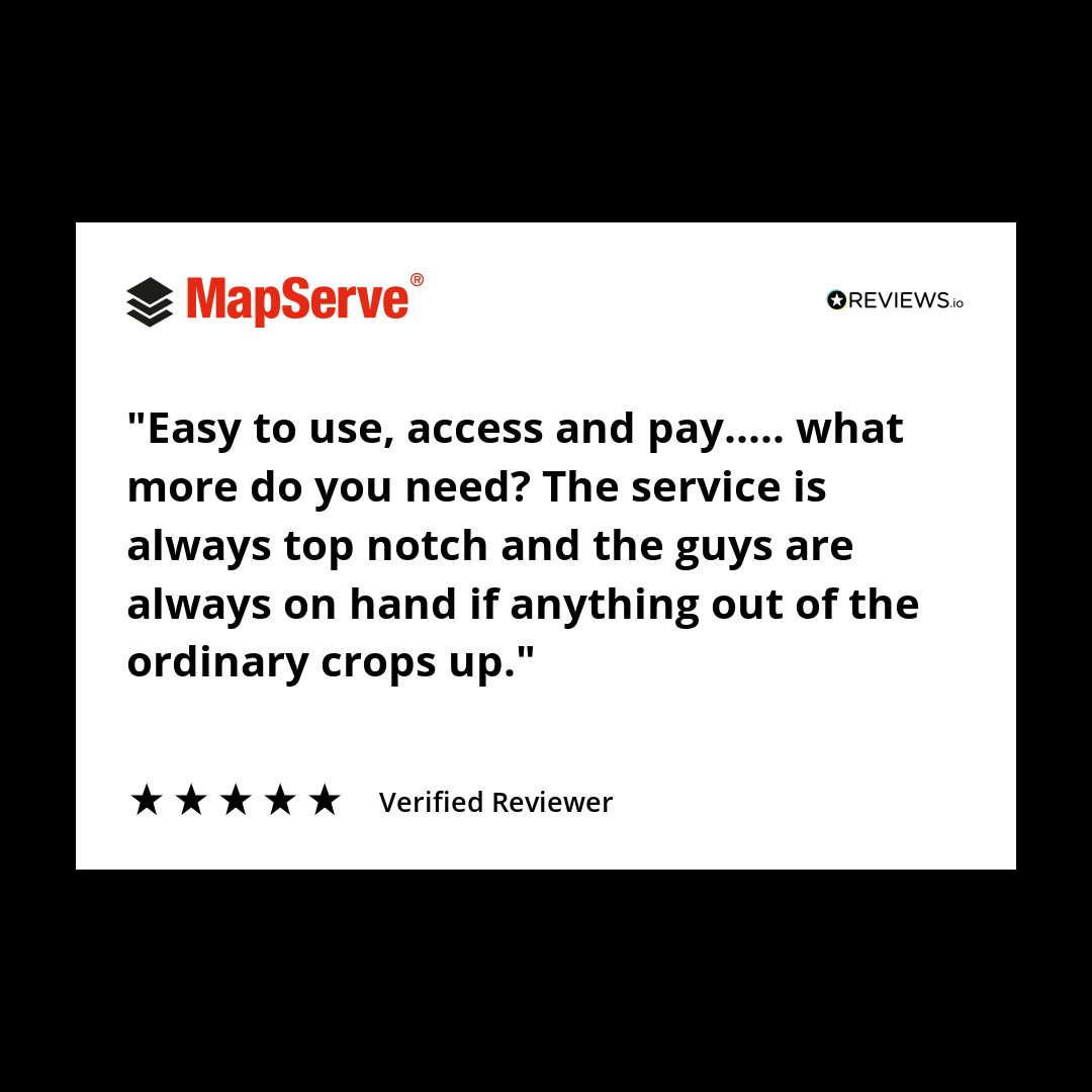
mapserve's tweet image. Fast access, fair pricing, and support that actually replies.

We don’t overcomplicate things. That’s the point.

#TestimonialTuesday #CustomerSupport #MappingTools #SitePlans #RemotePlanning #MapServe #PlanningWorkflows

🌍 Need to visualize your data quickly? Check out our guide on creating quick maps for free! Transform your information into engaging visuals in no time. #DataVisualization #MappingTools #FreeResources ift.tt/17CWJre #byAI


A lot of surveyors are still using outdated tools to calibrate land boundaries. We @adollatech are building something different — smart, fast & field-ready. If you work in mapping or boundary validation, you’ll want to keep an eye on this. #SurveyTech #MappingTools #LandSurvey

Kofi_Floki's tweet image. A lot of surveyors are still using outdated tools to calibrate land boundaries.
We @adollatech are building something different — smart, fast & field-ready.

If you work in mapping or boundary validation, you’ll want to keep an eye on this.

#SurveyTech #MappingTools #LandSurvey
Kofi_Floki's tweet image. A lot of surveyors are still using outdated tools to calibrate land boundaries.
We @adollatech are building something different — smart, fast & field-ready.

If you work in mapping or boundary validation, you’ll want to keep an eye on this.

#SurveyTech #MappingTools #LandSurvey
Kofi_Floki's tweet image. A lot of surveyors are still using outdated tools to calibrate land boundaries.
We @adollatech are building something different — smart, fast & field-ready.

If you work in mapping or boundary validation, you’ll want to keep an eye on this.

#SurveyTech #MappingTools #LandSurvey
Kofi_Floki's tweet image. A lot of surveyors are still using outdated tools to calibrate land boundaries.
We @adollatech are building something different — smart, fast & field-ready.

If you work in mapping or boundary validation, you’ll want to keep an eye on this.

#SurveyTech #MappingTools #LandSurvey

🗺️ New Map Alert! ​ The Namibia Topographic Map is now available on the SAGTA Map Downloader — plus two new projects: 📚 South Africa & 🌍 Global Map Projects ​ 🔗Visit the SAGTA Map Downloader: maps.sagta.org.za #Kartoza #GIS #MappingTools

KartozaGeo's tweet image. 🗺️ New Map Alert!
​
The Namibia Topographic Map is now available on the SAGTA Map Downloader — plus two new projects:
📚 South Africa & 🌍 Global Map Projects
​
🔗Visit the SAGTA Map Downloader: maps.sagta.org.za

#Kartoza #GIS #MappingTools

𝐒𝐧𝐚𝐩𝐩𝐢𝐧𝐠 𝐓𝐨𝐨𝐥𝐬 Create clean, accurate spatial data fast! Azimap's Snapping Tools connect new polygons to existing features, no overlaps no errors. Try it for yourself with a 30 day free trial: buff.ly/Cr76BzW #WebGIS #MappingTools #Azimap
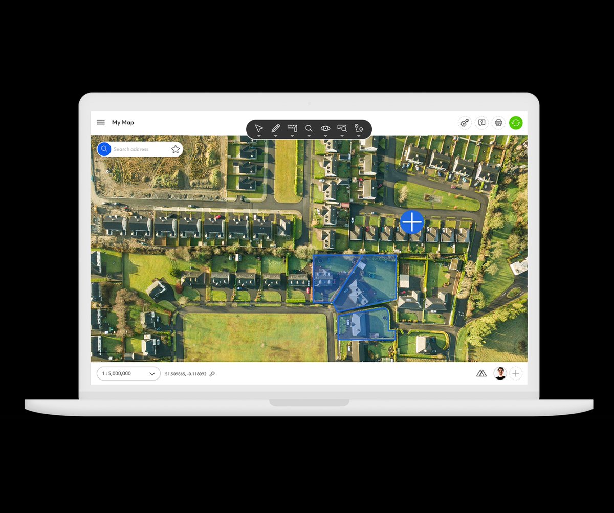
AzimapSoft's tweet image. 𝐒𝐧𝐚𝐩𝐩𝐢𝐧𝐠 𝐓𝐨𝐨𝐥𝐬 

Create clean, accurate spatial data fast! Azimap's Snapping Tools connect new polygons to existing features, no overlaps no errors.

Try it for yourself with a 30 day free trial: buff.ly/Cr76BzW 

#WebGIS #MappingTools #Azimap

From site selection to infrastructure planning, our geospatial tech stack unlocks speed + scale. PostGIS, DuckDB, GeoArrow & deck.gl working together = smooth, interactive maps. Take a look 👉 bit.ly/HPGDTLL #DataViz #Geospatial #MappingTools


New to GIS? Our ArcGIS Pro Intro course covers map navigation, data visualization, and spatial analysis—everything you need to build a strong foundation and unlock the power of ArcGIS. tcworkshop.com/pages/course-d… #ArcGISPro #MappingTools
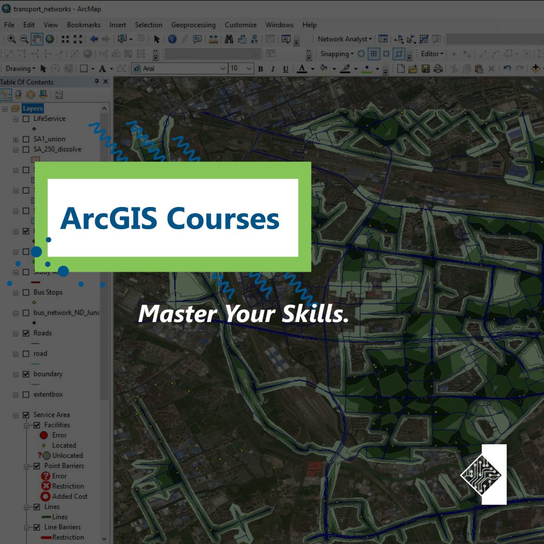
tcworkshop's tweet image. New to GIS? Our ArcGIS Pro Intro course covers map navigation, data visualization, and spatial analysis—everything you need to build a strong foundation and unlock the power of ArcGIS.
tcworkshop.com/pages/course-d…
#ArcGISPro #MappingTools

Looking for the perfect GPS for surveying & mapping? 🛰️ Get expert tips + top picks today! 🛒 Shop now: geoinfostore.com #GPSDevice #Surveying #MappingTools #GeoStore #Geoinfotech

geoinfotechstor's tweet image. Looking for the perfect GPS for surveying & mapping? 🛰️
Get expert tips + top picks today!
🛒 Shop now: geoinfostore.com
#GPSDevice #Surveying #MappingTools #GeoStore #Geoinfotech
geoinfotechstor's tweet image. Looking for the perfect GPS for surveying & mapping? 🛰️
Get expert tips + top picks today!
🛒 Shop now: geoinfostore.com
#GPSDevice #Surveying #MappingTools #GeoStore #Geoinfotech
geoinfotechstor's tweet image. Looking for the perfect GPS for surveying & mapping? 🛰️
Get expert tips + top picks today!
🛒 Shop now: geoinfostore.com
#GPSDevice #Surveying #MappingTools #GeoStore #Geoinfotech

New to GIS? Our ArcGIS Pro Intro course covers map navigation, data visualization, and spatial analysis—everything you need to build a strong foundation and unlock the power of ArcGIS. tcworkshop.com/pages/course-d… #ArcGISPro #MappingTools

tcworkshop's tweet image. New to GIS? Our ArcGIS Pro Intro course covers map navigation, data visualization, and spatial analysis—everything you need to build a strong foundation and unlock the power of ArcGIS.
tcworkshop.com/pages/course-d…
#ArcGISPro #MappingTools

🧰 18+ Extensions. One Plugin. Endless Possibilities. Whether you're mapping users, posts, or custom tables — WP Maps Pro has an extension for that! 🚀 Unlock the map power: wpmapspro.com #WordPressDev #MappingTools #WPMapsPro #WePlugins

weplugins's tweet image. 🧰 18+ Extensions. One Plugin. Endless Possibilities.

Whether you're mapping users, posts, or custom tables — WP Maps Pro has an extension for that!

🚀 Unlock the map power: wpmapspro.com

#WordPressDev #MappingTools #WPMapsPro #WePlugins

10 years. Zero issues. That’s what we aim for. And it’s why professionals keep coming back. #TestimonialTuesday #MappingTools #CustomerLoyalty #PlanningWorkflows #ArchitectsUK #MapServe #TrustedByProfessionals

mapserve's tweet image. 10 years. Zero issues.

That’s what we aim for. And it’s why professionals keep coming back.

#TestimonialTuesday #MappingTools #CustomerLoyalty #PlanningWorkflows #ArchitectsUK #MapServe #TrustedByProfessionals

A lot of surveyors are still using outdated tools to calibrate land boundaries. We @adollatech are building something different — smart, fast & field-ready. If you work in mapping or boundary validation, you’ll want to keep an eye on this. #SurveyTech #MappingTools #LandSurvey

Kofi_Floki's tweet image. A lot of surveyors are still using outdated tools to calibrate land boundaries.
We @adollatech are building something different — smart, fast & field-ready.

If you work in mapping or boundary validation, you’ll want to keep an eye on this.

#SurveyTech #MappingTools #LandSurvey
Kofi_Floki's tweet image. A lot of surveyors are still using outdated tools to calibrate land boundaries.
We @adollatech are building something different — smart, fast & field-ready.

If you work in mapping or boundary validation, you’ll want to keep an eye on this.

#SurveyTech #MappingTools #LandSurvey
Kofi_Floki's tweet image. A lot of surveyors are still using outdated tools to calibrate land boundaries.
We @adollatech are building something different — smart, fast & field-ready.

If you work in mapping or boundary validation, you’ll want to keep an eye on this.

#SurveyTech #MappingTools #LandSurvey
Kofi_Floki's tweet image. A lot of surveyors are still using outdated tools to calibrate land boundaries.
We @adollatech are building something different — smart, fast & field-ready.

If you work in mapping or boundary validation, you’ll want to keep an eye on this.

#SurveyTech #MappingTools #LandSurvey

Gain unparalleled insight in your tilesets with the Tileset explorer, launched today! Visualize tileset statistics and metadata for deep understanding about your data distribution and size. buff.ly/391gYbC #mapbox #mappingtools

Mapbox's tweet image. Gain unparalleled insight in your tilesets with the Tileset explorer, launched today! Visualize tileset statistics and metadata for deep understanding about your data distribution and size. buff.ly/391gYbC #mapbox #mappingtools

Creating a Leaflet Map with Inset Globe buff.ly/1VPsHza #interactivemaps drive engagement #mappingtools
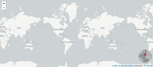
MapsPLUScom's tweet image. Creating a Leaflet Map with Inset Globe buff.ly/1VPsHza #interactivemaps drive engagement #mappingtools

Have you been using our Transpo Injury Mapping System? Updated TIMS website: tims.berkeley.edu #trafficsafety #mappingtools #SWITRS

UCBSafeTREC's tweet image. Have you been using our Transpo Injury Mapping System? Updated TIMS website: tims.berkeley.edu #trafficsafety #mappingtools #SWITRS

📍#GeoforGood23 Summit took place last week and the #SERVIRAmazonia team was well-represented 🙌🏼 The event gathered professionals worldwide using @Google #mappingtools for planetary #sustainability @googleearth @SERVIRGlobal @sig_gis @Imaflora @amazonacca 🌳 1/2

ServirAmazonia's tweet image. 📍#GeoforGood23 Summit took place last week and the #SERVIRAmazonia team was well-represented 🙌🏼 The event gathered professionals worldwide using @Google #mappingtools for planetary #sustainability @googleearth @SERVIRGlobal @sig_gis @Imaflora @amazonacca 🌳 1/2

Did you know? Our network of customers includes over 2.7 million registered #developers around the globe. Discover why developers love our powerful #mappingtools: mapbox.com/maps

Mapbox's tweet image. Did you know? Our network of customers includes over 2.7 million registered #developers around the globe. Discover why developers love our powerful #mappingtools: mapbox.com/maps

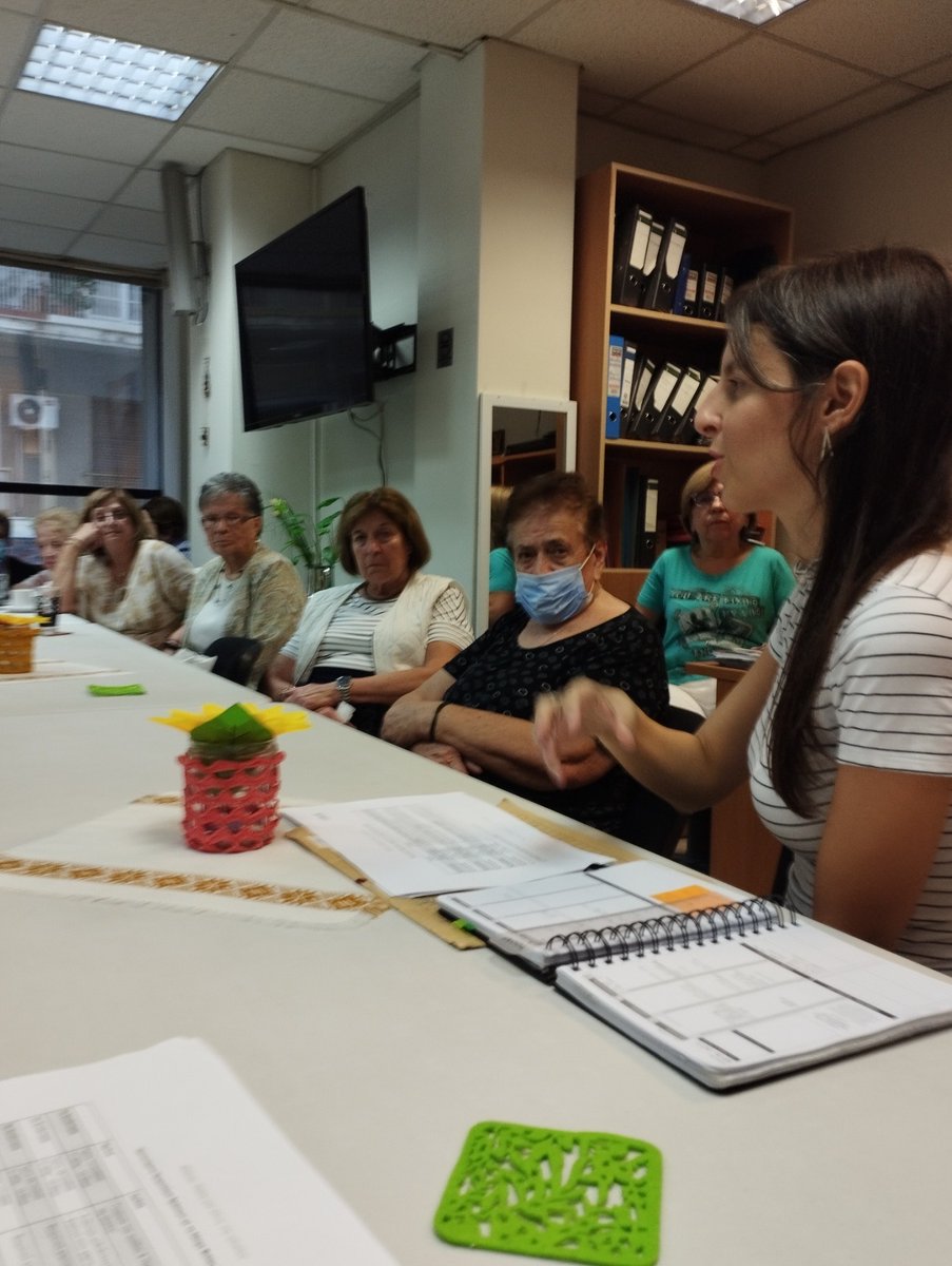
Α new project just began! Athens: A city for all ages In the following months together with the Friendship Club of Kypseli, we will record the everyday needs of the elderly in the neighbourhoods of Kypseli, through #exploratorywalks and other #mappingtools. #TIMA #PointsofSupport

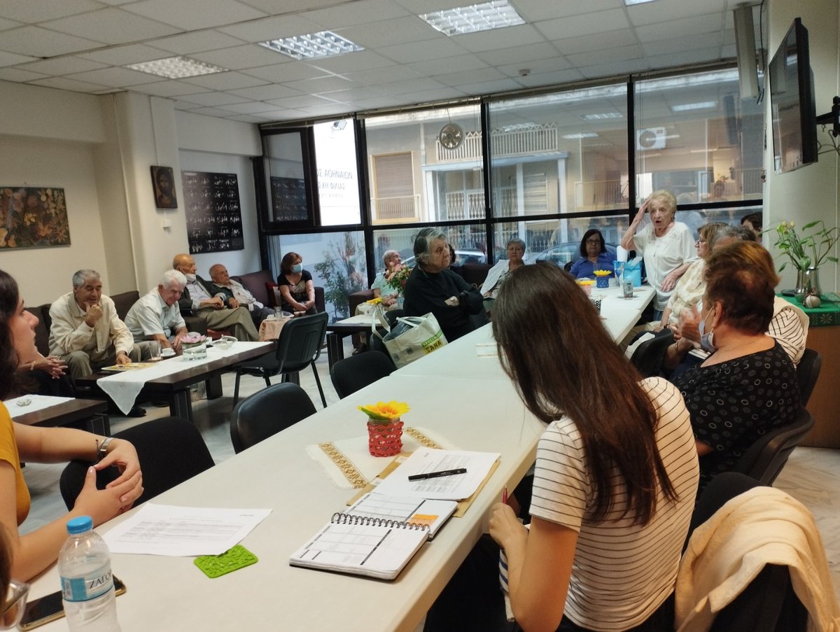
urbana_lab's tweet image. Α new project just began!
Athens: A city for all ages
In the following months together with the Friendship Club of Kypseli, we will record the everyday needs of the elderly in the neighbourhoods of Kypseli, through #exploratorywalks and other #mappingtools.
#TIMA #PointsofSupport

Unlock property ownership insights with mapping tools, GIS, and public records! 🏘️ Discover how you can simplify real estate research and transactions in our latest guide. tycoonstory.com/why-mapping-to… #realestate #gis #mappingtools #propertyownership #realestateinvesting

TycoonStoryCo's tweet image. Unlock property ownership insights with mapping tools, GIS, and public records! 🏘️ 

Discover how you can simplify real estate research and transactions in our latest guide.

tycoonstory.com/why-mapping-to…

#realestate #gis #mappingtools #propertyownership #realestateinvesting

Looking for the perfect GPS for surveying & mapping? 🛰️ Get expert tips + top picks today! 🛒 Shop now: geoinfostore.com #GPSDevice #Surveying #MappingTools #GeoStore #Geoinfotech

geoinfotechstor's tweet image. Looking for the perfect GPS for surveying & mapping? 🛰️
Get expert tips + top picks today!
🛒 Shop now: geoinfostore.com
#GPSDevice #Surveying #MappingTools #GeoStore #Geoinfotech
geoinfotechstor's tweet image. Looking for the perfect GPS for surveying & mapping? 🛰️
Get expert tips + top picks today!
🛒 Shop now: geoinfostore.com
#GPSDevice #Surveying #MappingTools #GeoStore #Geoinfotech
geoinfotechstor's tweet image. Looking for the perfect GPS for surveying & mapping? 🛰️
Get expert tips + top picks today!
🛒 Shop now: geoinfostore.com
#GPSDevice #Surveying #MappingTools #GeoStore #Geoinfotech

🗺️ New Map Alert! ​ The Namibia Topographic Map is now available on the SAGTA Map Downloader — plus two new projects: 📚 South Africa & 🌍 Global Map Projects ​ 🔗Visit the SAGTA Map Downloader: maps.sagta.org.za #Kartoza #GIS #MappingTools

KartozaGeo's tweet image. 🗺️ New Map Alert!
​
The Namibia Topographic Map is now available on the SAGTA Map Downloader — plus two new projects:
📚 South Africa & 🌍 Global Map Projects
​
🔗Visit the SAGTA Map Downloader: maps.sagta.org.za

#Kartoza #GIS #MappingTools

Check out the Alien Forest Pest Explorer, an interactive tool providing pest distribution for 89 pests. Look by county, specific pest, or top 10 pests. #Pests #MappingTools mapsweb.lib.purdue.edu/AFPE/?_ga=2.19…
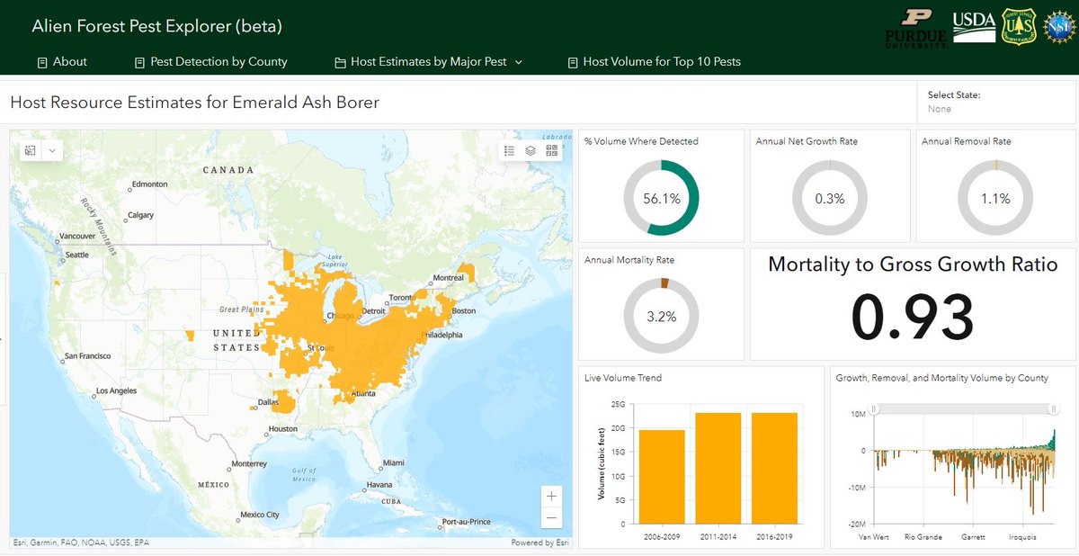
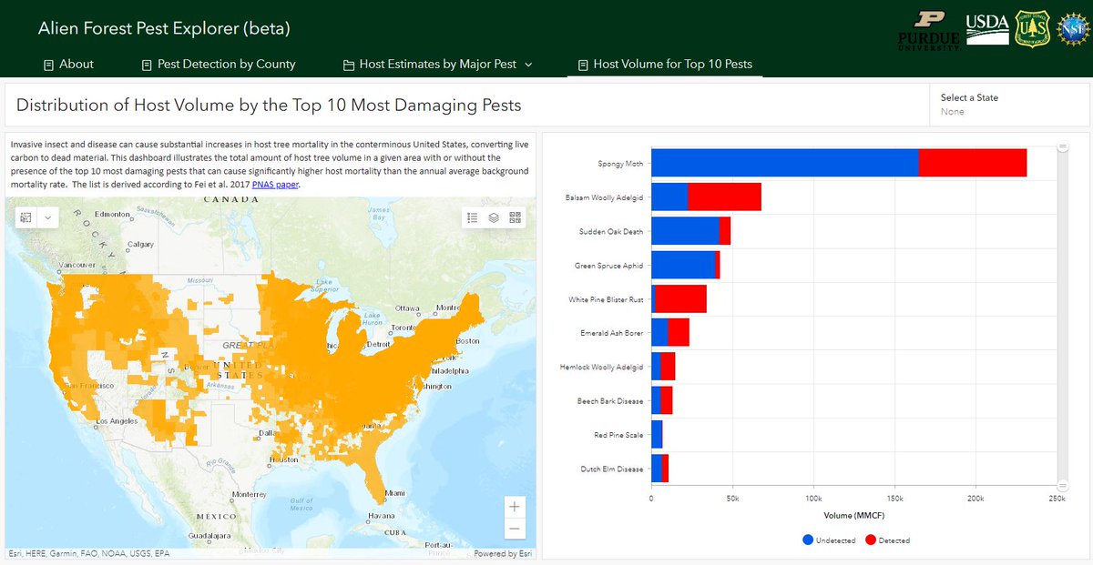
CNNF002's tweet image. Check out the Alien Forest Pest Explorer, an interactive tool providing pest distribution for 89 pests. Look by county, specific pest, or top 10 pests. #Pests #MappingTools mapsweb.lib.purdue.edu/AFPE/?_ga=2.19…

Recently released #mappingtools from @facebook will help travelers, first responders, and community leaders make sense of #unpavedroads. blog.midwestind.com/facebooks-new-…

MidwestInd's tweet image. Recently released #mappingtools from @facebook will help travelers, first responders, and community leaders make sense of #unpavedroads. blog.midwestind.com/facebooks-new-…

State technology experts want Tennesseans to use new #mappingtools they've made available, and have now produced instructional videos to help. More at greeneville.com/news.

WGRVnews's tweet image. State technology experts want Tennesseans to use new #mappingtools they've made available, and have now produced instructional videos to help. More at greeneville.com/news.

#MappingTools identify potential climate-related risk factors to protect locations and groups of people. bit.ly/2kFcY8R @CDCgov
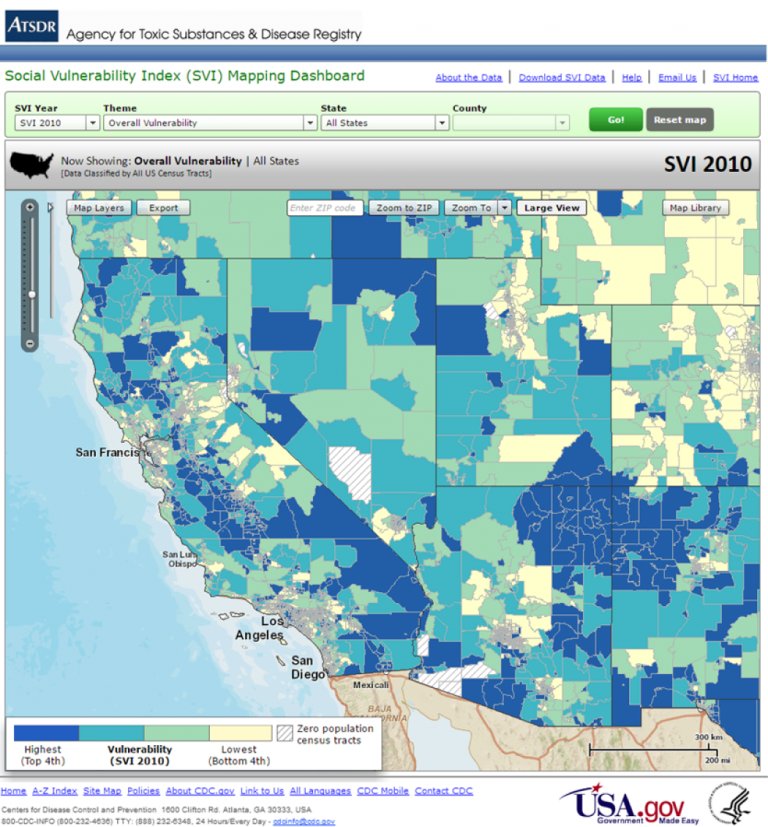
usgcrp's tweet image. #MappingTools identify potential climate-related risk factors to protect locations and groups of people. bit.ly/2kFcY8R @CDCgov

🧰 18+ Extensions. One Plugin. Endless Possibilities. Whether you're mapping users, posts, or custom tables — WP Maps Pro has an extension for that! 🚀 Unlock the map power: wpmapspro.com #WordPressDev #MappingTools #WPMapsPro #WePlugins

weplugins's tweet image. 🧰 18+ Extensions. One Plugin. Endless Possibilities.

Whether you're mapping users, posts, or custom tables — WP Maps Pro has an extension for that!

🚀 Unlock the map power: wpmapspro.com

#WordPressDev #MappingTools #WPMapsPro #WePlugins

𝐒𝐧𝐚𝐩𝐩𝐢𝐧𝐠 𝐓𝐨𝐨𝐥𝐬 Create clean, accurate spatial data fast! Azimap's Snapping Tools connect new polygons to existing features, no overlaps no errors. Try it for yourself with a 30 day free trial: buff.ly/Cr76BzW #WebGIS #MappingTools #Azimap

AzimapSoft's tweet image. 𝐒𝐧𝐚𝐩𝐩𝐢𝐧𝐠 𝐓𝐨𝐨𝐥𝐬 

Create clean, accurate spatial data fast! Azimap's Snapping Tools connect new polygons to existing features, no overlaps no errors.

Try it for yourself with a 30 day free trial: buff.ly/Cr76BzW 

#WebGIS #MappingTools #Azimap

Fast access, fair pricing, and support that actually replies. We don’t overcomplicate things. That’s the point. #TestimonialTuesday #CustomerSupport #MappingTools #SitePlans #RemotePlanning #MapServe #PlanningWorkflows

mapserve's tweet image. Fast access, fair pricing, and support that actually replies.

We don’t overcomplicate things. That’s the point.

#TestimonialTuesday #CustomerSupport #MappingTools #SitePlans #RemotePlanning #MapServe #PlanningWorkflows

Loading...

Something went wrong.


Something went wrong.


United States Trends