#srtm search results

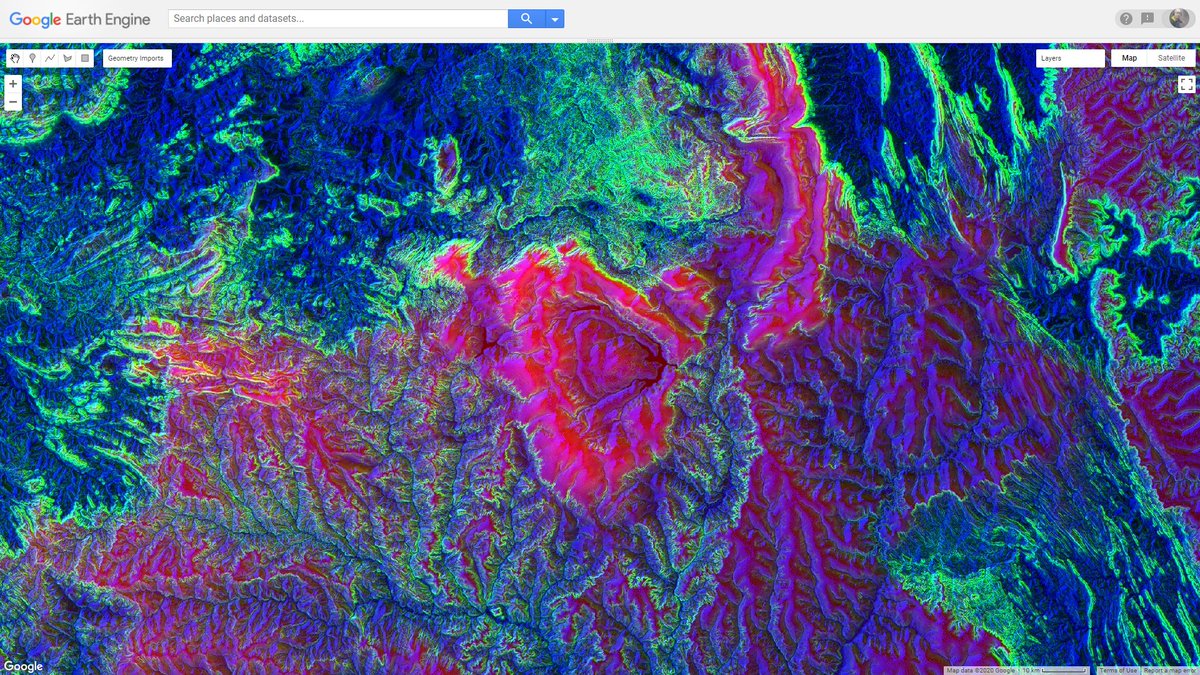
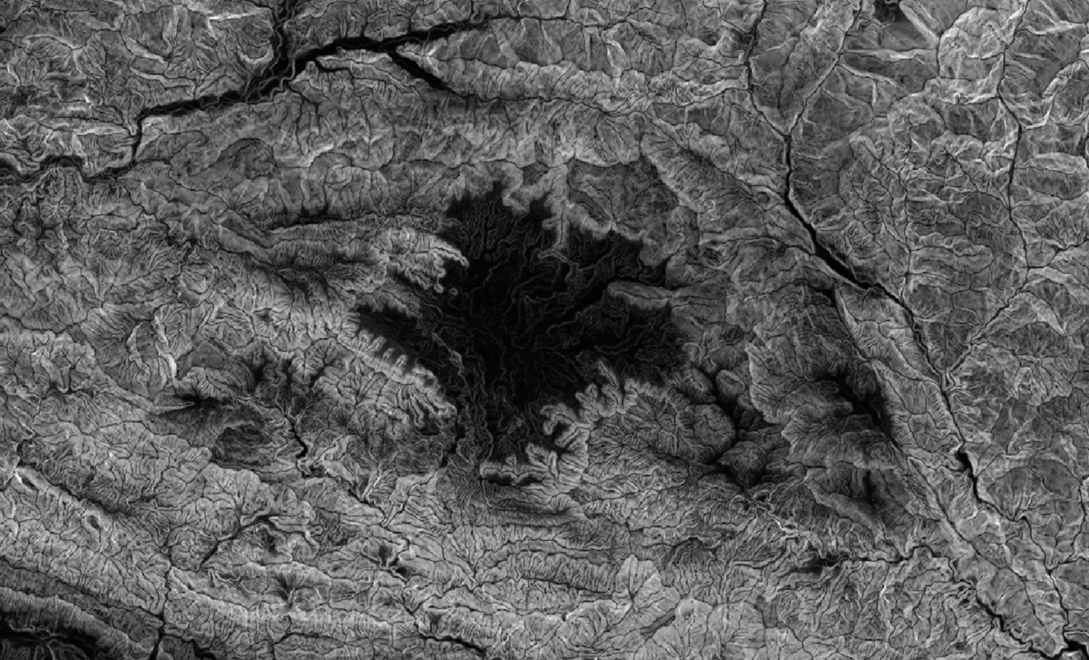
Gosto de tirar onda de artista. Brincando com #SRTM no #EarthEngine R - elevation G - slope B - aspect
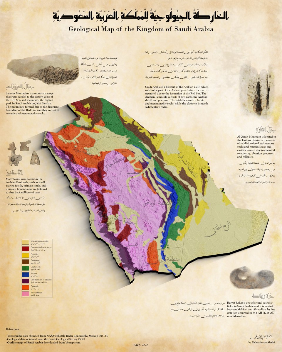
انتهيت اليوم من مشروعي البسيط ولله الحمد. A small project I had been working on. #blender #Gimp #SRTM #geology @SgsOrgSa @SaudiGeology


¡#BuenosDías! Migraciones humanas • vía @simongerman600 #VideoCiencia roughnecktwozero/Reddit con datos de elevación #SRTM de @NASAEarthData


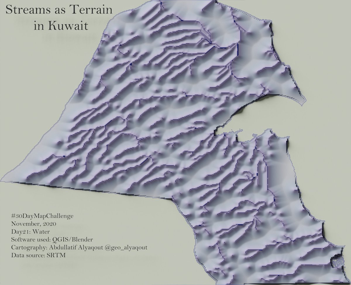
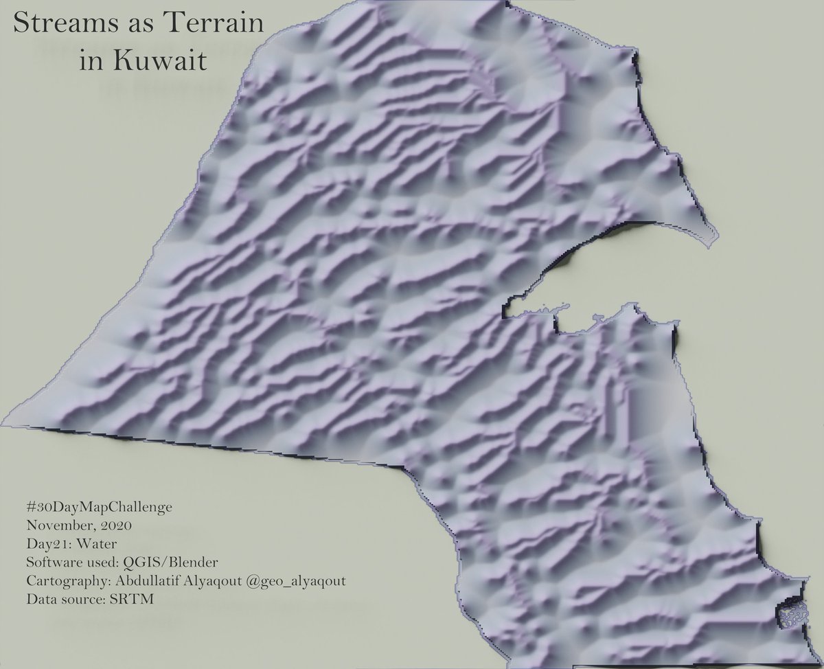
#30DayMapChallenge Day21: Water Title: Streams as Terrain in #Kuwait Software used: @qgis & @Blender The data were from #SRTM The heights are proximity distance to streams #cartography #Geography
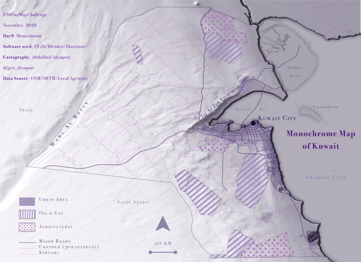
#30DayMapChallenge Day9: Monochrome Title: Monochrome map of Kuwait The data used are from @openstreetmap , #SRTM, and local agencies I used @qgis, @Illustrator, and @Blender #cartography #geography #gis #kuwait #b3d #qgis


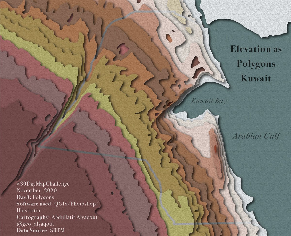
#30DayMapChallenge Day3: Polygons Title: Elevation as Polygons, Kuwait The data used are from #SRTM I used @qgis, @Photoshop, and @Illustrator The elevations were generalized, and the colors are arbitrary I know, terrible colors!! #cartography #geography #gis #kuwait


#30DayMapChallenge Day 11: 3D Ran out of time and not exactly how I wanted it but some renders of Mt Etna made with #b3d and #srtm data. Trying to play around with clouds/mist but it just breaks my computer


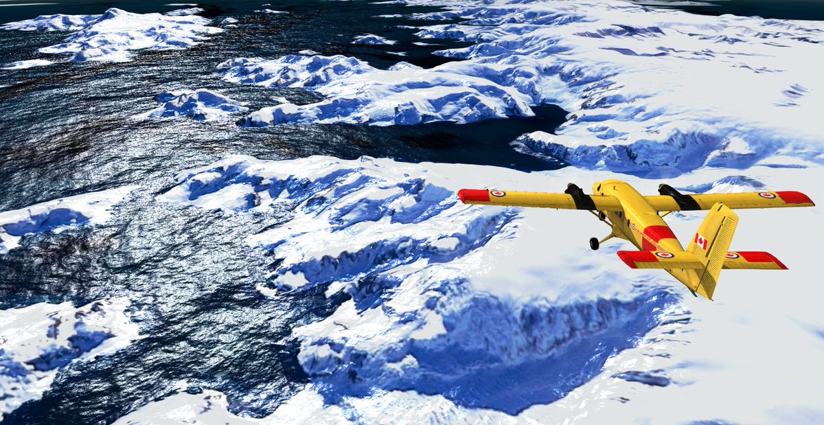
GeoFS digital elevation data has been updated to overcome #SRTM limitations (missing data beyond 60°N and 54°S). It is now possible to visit Norwegian fjords, do bush flying in Alaska or rescue missions to the south pole!
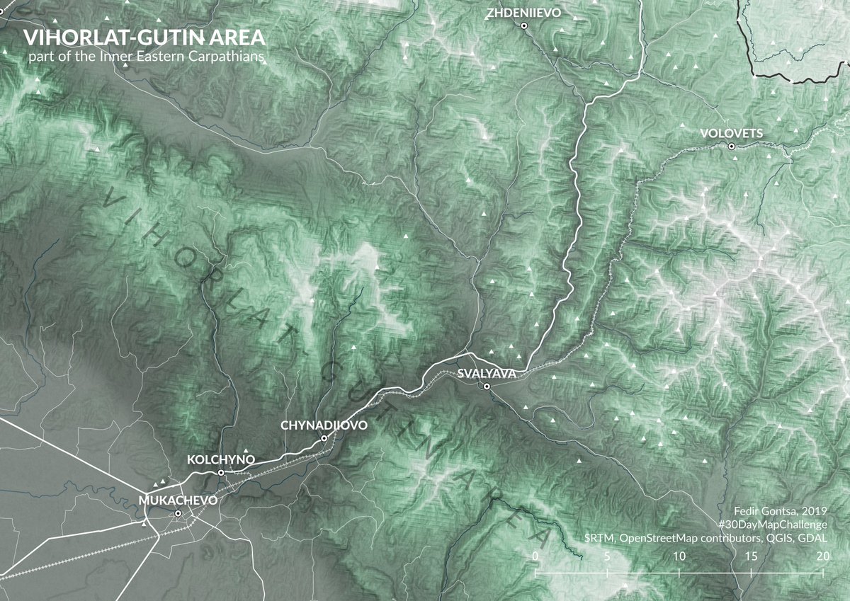
Vihorlat-Gutin Area part of the Inner Eastern Carpathians #30DayMapChallenge Day 11: Elevation #SRTM #OpenStreetMap contributors #QGIS

Modelo aproximado de inundação do Centro Histórico de #PortoAlegre Nível do #Guaíba: de 3m (cota de inundação) até 5m (+/- partes da Rua da "Praia", por isso o nome) Baseado em Modelo de Terreno (DEM) @NASA #SRTM Mapa e Prédios @openstreetmap #PMPA #chuva
Previsão gráfica simples, na mão Subida do #Guaíba até amanhã nesta mesma hora pode fácil passar dos 4m


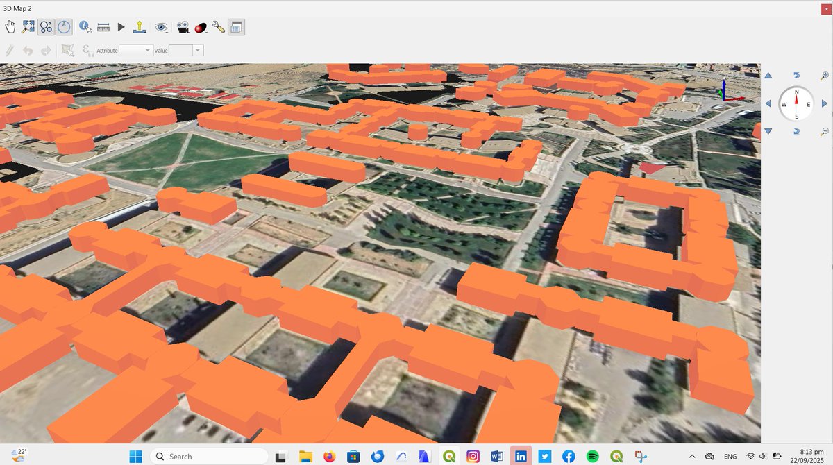
Good evening for all! I have to celebrate this. Not very interesting graphically, but I am so happy of this first result. My first 3d #GIS view using #QGIS, #srtm 30m #DEM and data from #OSM. University of Batna in #Algeria.

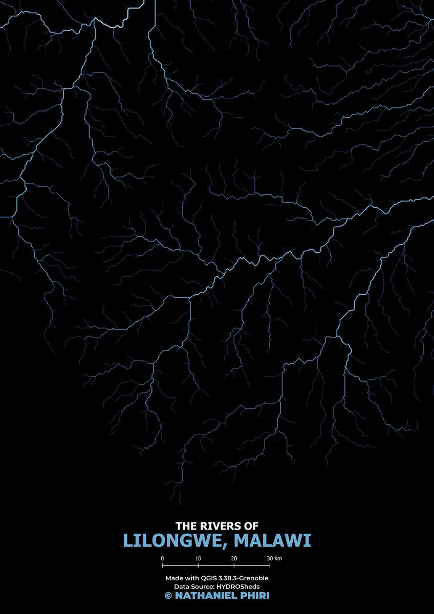
Here are maps 🗺️ showing the rivers of Africa and Lilongwe, Malawi made with @qgis #GIS #QGIS #SRTM #ArcMap #Excel #DEM #LULC #ESRI #DataViz #DataAnalytics #Geospatial #OpenStreetMap #OSM #Sentinel #Topography #Mapping #Cartograph #Rivers #HydroSHEDS #gischat


19. Good luck! If you find this thread valuable, kindly consider reposting. #GIS #QGIS #SRTM #ArcMap #Excel #DEM #LULC #ESRI #DataViz #DataAnalytics #Geospatial #OpenStreetMap #OSM #Sentinel #Topography #Mapping #Cartography
If you find this post valuable, kindly consider reposting. #GIS #Raster #SRTM #DEM #QGIS #Geospatial #Topography #Hydrology #Climatology #RemoteSensing #DataViz #Sustainability #ArcGIS #Python #GDAL #R #RStudio #Rasterio #GoogleEarth #GoogleEarthEngine

Quickly Download SRTM DEM Data for Any Study Area Using QGIS Tutorial link: youtu.be/RjApJy5BaUw #SEO #QGIS #SRTM #DEM #RemoteSensing #GIS #Geospatial #Topography #ElevationData #Mapping #SpatialAnalysis #TerrainModeling #DigitalElevationModel #Geoinformatics

How a Space Shuttle mission revolutionised Earth observation @DLR_en #satellitedata #earthobservation #srtm #digitalelevationmodel dlr.de/en/latest/news…


geomorphometry2025.org #geomorphometry #srtm #dem #gis #remotesensing #science #italy #perugia #meeting #arcgis #qgis #grassgis #saga #whitebox #python #r #julia @CNR_IRPI @CNRsocial_ @CNRDTA @UniperugiaNews


ISPOL - Cotas por Cores Uma das muitas utilidades contidas no ISTRAM é a de atribuir um esquema de cores às cotas. #srtm #istram jcoimbras.blogspot.com/2024/12/ispol-…


👋👋 #Glacier Mass Balance in the Manas River Using Ascending and Descending Pass of #Sentinel 1A/1B Data and #SRTM #DEM ✍️ Lili Yan et al. 📎 brnw.ch/21wNIxs


#30DayMapChallenge Day21: Water Title: Streams as Terrain in #Kuwait Software used: @qgis & @Blender The data were from #SRTM The heights are proximity distance to streams #cartography #Geography
#30DayMapChallenge Day9: Monochrome Title: Monochrome map of Kuwait The data used are from @openstreetmap , #SRTM, and local agencies I used @qgis, @Illustrator, and @Blender #cartography #geography #gis #kuwait #b3d #qgis
#30DayMapChallenge Day3: Polygons Title: Elevation as Polygons, Kuwait The data used are from #SRTM I used @qgis, @Photoshop, and @Illustrator The elevations were generalized, and the colors are arbitrary I know, terrible colors!! #cartography #geography #gis #kuwait


انتهيت اليوم من مشروعي البسيط ولله الحمد. A small project I had been working on. #blender #Gimp #SRTM #geology @SgsOrgSa @SaudiGeology
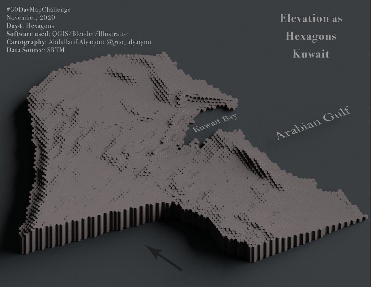
#30DayMapChallenge Day4: Hexagons Title: Elevation as Hexagons, Kuwait The data used are from #SRTM I used @qgis, @Blender, and @Illustrator I created hex grids, then applied zonal statistics to get the mean Rendered in @blender #cartography #geography #gis #kuwait #b3d
#30DayMapChallenge Day 11: 3D Ran out of time and not exactly how I wanted it but some renders of Mt Etna made with #b3d and #srtm data. Trying to play around with clouds/mist but it just breaks my computer
Gosto de tirar onda de artista. Brincando com #SRTM no #EarthEngine R - elevation G - slope B - aspect

Vihorlat-Gutin Area part of the Inner Eastern Carpathians #30DayMapChallenge Day 11: Elevation #SRTM #OpenStreetMap contributors #QGIS

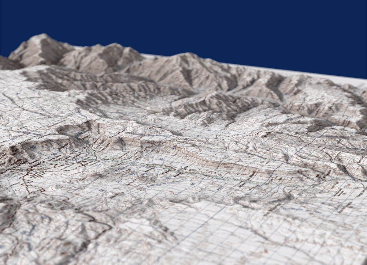
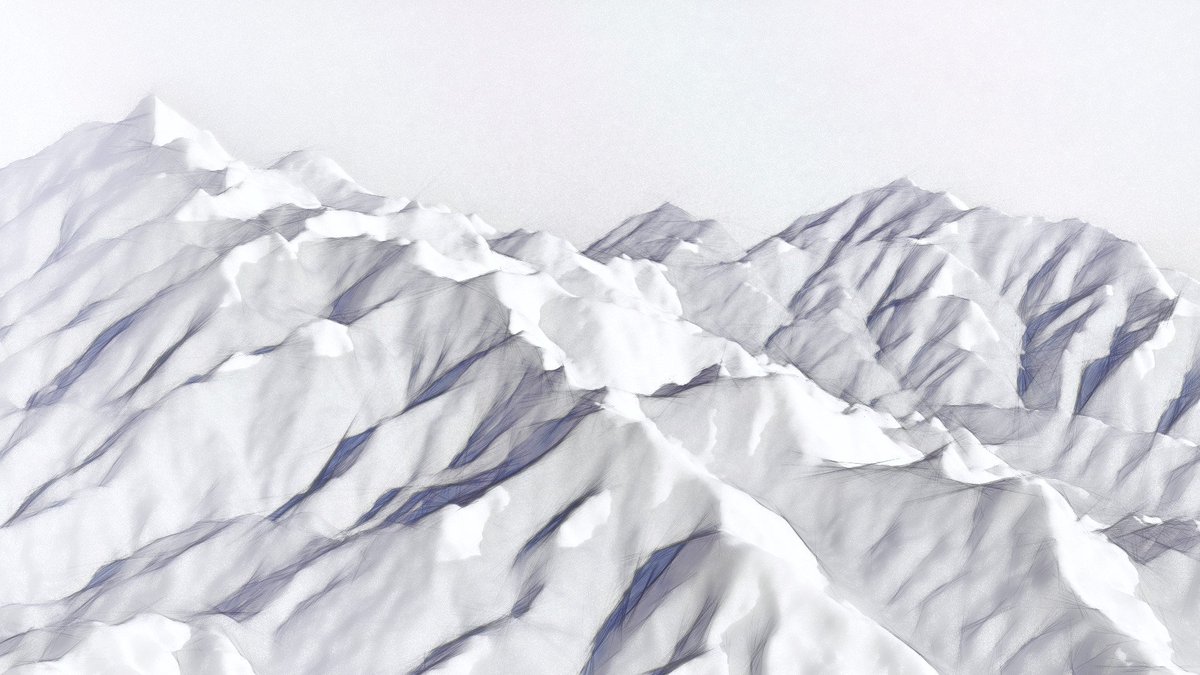
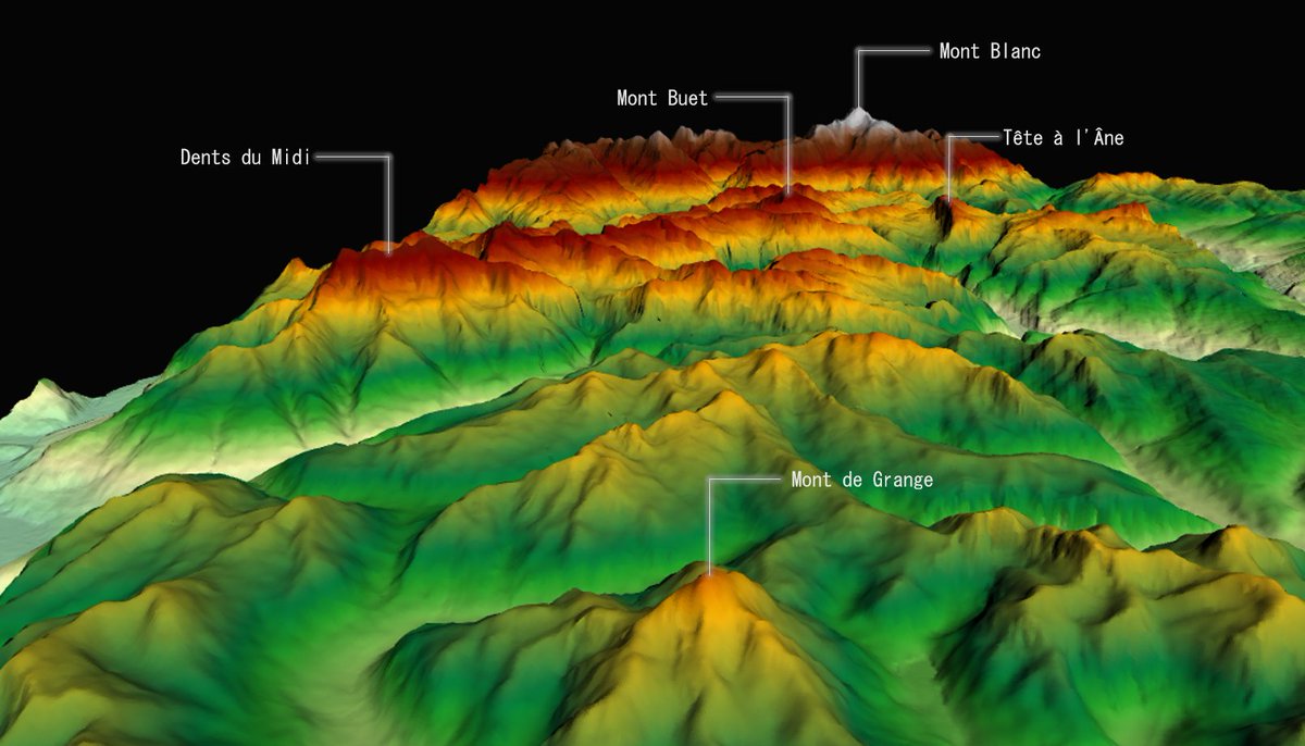
#30DayMapChallenge Day 5: Rasters - French/Swiss Alps, looking towards Mont Blanc from Chatel #DEM #SRTM #3d #opensource #QGIS #gischat #geography #cartography


Something went wrong.
Something went wrong.
United States Trends
- 1. #GMMTV2026 236K posts
- 2. Moe Odum N/A
- 3. #WWERaw 75.9K posts
- 4. Purdy 28.2K posts
- 5. Panthers 37.7K posts
- 6. Finch 14.4K posts
- 7. Bryce 21.2K posts
- 8. TOP CALL 9,207 posts
- 9. Keegan Murray 1,509 posts
- 10. Gonzaga 4,066 posts
- 11. 49ers 42.1K posts
- 12. Canales 13.4K posts
- 13. Timberwolves 3,859 posts
- 14. AI Alert 7,870 posts
- 15. Alan Dershowitz 2,616 posts
- 16. Market Focus 4,711 posts
- 17. Check Analyze 2,369 posts
- 18. #FTTB 5,913 posts
- 19. Penta 10.7K posts
- 20. Token Signal 8,476 posts